
Blog Layout
Muskrat Removal

Muskrat summary: Still Meadows HOA entered in an agreement with retired Conservation Officer Joe Morelock to trap muskrats. The muskrats have been burrowing under the banks of the subdivision ponds, creating sink holes that can erode the bank and cause walking hazards for residents. Mr. Morelock started his work with the trapping season in November. He utilized tactics to keep residential pets and kids safe and quickly remove the unwanted pests. Mr. Morelock was extremely successful this season by removing a total of 20 muskrats and 1 mink. Additionally he continues to watch for otters and other pests that could be detrimental to the ecosystem. The season for muskrats is currently over, however Mr. Morelock is dedicated to our subdivision and will continue his work when the trapping season allows. We appreciate everyone’s cooperation in our efforts to improve our ponds habitats.
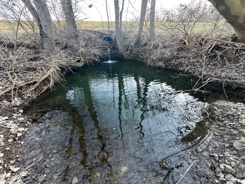
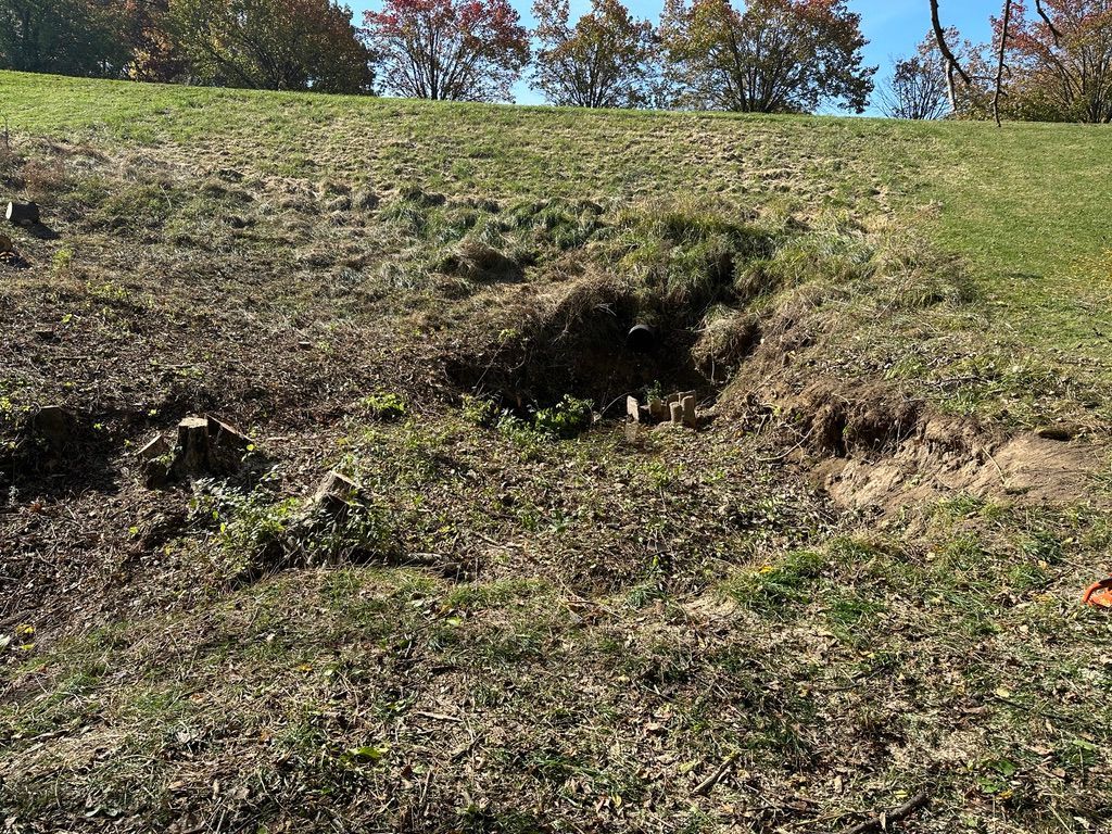
The picture above shows the 3 dam locations. The area shown with the yellow outline is the common area at the north dam. The north dam is the most important to the SMHOA. The other 2 dams drain into the north dam. If one of the other dams fails, the north dam will need to slow the release of the ponds. The north dam outlets into Indian Creek which parallels Indian Point Road. If the north dam fails, Indian Point Road would be threatened. Thankfully, no homes are located along Indian Creek immediately downstream of our subdivision. The outlet of the north dam is very similar to the west dam outlet that was protected in the Fall 2024. The dam outlet consists of the overflow structure in the north pond. The overflow shown in Figure 1, drops, and runs under the north dam. Figure 2 shows the outlet of the dam in the common area. The outlet is approximately 6’ above the bottom of the creek due to the force of the water dropping into the creek. Erosion has lowered the creek bottom and creek banks. The trees in the area have exposed roots due to the erosion of the flowing water. With the roots exposed, the tress become unstable and fall into the creek. These fallen trees cause more erosion as the water must fight it’s way past these obstructions. The outlet needs to be stabilized to prevent failure of the north dam. The trees with exposed roots will be removed. This summer as the creek dries out, riprap will be placed below the outlet pipe. This riprap will be placed in the creek for 25’ downstream of the outlet pipe to protect the creek. A rough estimate of the riprap needed is 170 tons delivered $4800. If the material can be purchased from the Road Commissioner, the price will drop to $2500. The additional funding requested for the maintenance of the north dam will be used to place riprap on the face of the dam. This riprap will stabilize the dam against rising water levels during heavy rains. The face should be riprapped to the low point of the emergency overflow. More photos to follow showing blockages downstream causing backing up of water, some natural, some by dumping of leaves etc.
Construction was needed to protect the outlet pipe of the dam. The land around the outlet of the west dam was eroding which left the pipe end unsupported. If the pipe broke, the dam could fail. Dam failure would result in Still Meadows St to washing away and if this happened suddenly, then there would be considerable damage in and around the creek as well as increased pressure on the north dam. The weekend of November 2nd and 3rd the Association held a work weekend to clear the land to enable access to the pipe by the HOA Members. A week later the Road Commissioner and his crew assisted with the repair since the roadway was threatened. The ground was shaped to support the outlet pipe. Barrier material and riprap was placed around the pipe and approximately 25' downstream of the pipe to diffuse the power of the running water and slow the flow. This area will be monitored to ensure erosion of the creek is limited. Many thanks to all workday volunteers who helped in this effort. See transition photos below.